
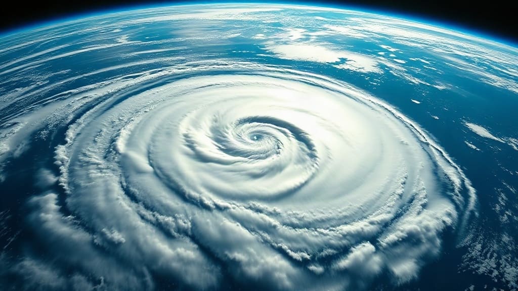
If you live along the Pacific coast, you've probably noticed the tropics have been unusually busy this year. Since the season began in mid-May, the eastern Pacific has spawned a parade of named storms, several of which rapidly intensified into major hurricanes. And according to forecasters, we're only halfway through. The peak months of August, September, and October are still ahead, and conditions remain primed for more development. This isn't just a fluke; it's the result of a complex interplay of ocean temperatures, atmospheric patterns, and perhaps a bit of climate change thrown in. Understanding what's happening can help residents and policymakers prepare for what's still to come.
A Season That Started Early and Hasn't Let Up
The 2025 Pacific hurricane season officially kicked off on May 15 in the eastern Pacific and June 1 in the central Pacific. But unlike some years when the first storm doesn't form until July, this season wasted no time. By late May, Tropical Storm Aletta had already formed, and it was just the beginning. June brought Hurricane Bud, a Category 4 storm that churned off the coast of Mexico, and July saw the formation of Hurricane Carlotta, which briefly threatened the Baja California peninsula. By early August, the basin had already recorded more named storms and accumulated cyclone energy (ACE) than the entire 2024 season. That's a striking statistic, and it underscores just how unusual this year has been.
What's behind this burst of activity? The answer lies in the Pacific Ocean itself, where sea surface temperatures have been running well above average across a vast stretch from Mexico to Hawaii. Warmer ocean water acts like jet fuel for hurricanes, providing the energy they need to form and intensify. When waters are as warm as they have been, even modest atmospheric disturbances can quickly spin up into named storms. And that's exactly what we've seen: numerous systems that developed rapidly, sometimes going from a tropical depression to a major hurricane in less than 48 hours.
The Role of La Niña and Other Climate Patterns
While warm water is the primary ingredient, other climate patterns have also played a part. One key player is La Niña, the cool phase of the El Niño-Southern Oscillation (ENSO). During La Niña, the eastern Pacific tends to see reduced wind shear, meaning the winds that can tear apart developing storms are weaker. With less shear, hurricanes can grow taller and more organized. Additionally, La Niña often shifts the jet stream northward, allowing tropical systems to wander further north than they might otherwise. This year, La Niña conditions have been present, albeit weakly at times, and that has likely contributed to the active season.
Another factor is the Madden-Julian Oscillation (MJO), a pulse of cloud and rainfall that travels eastward around the globe every 30 to 60 days. When the MJO is in a favorable phase over the eastern Pacific, it can enhance storm activity. This year, the MJO has been particularly active, and its timing has coincided with periods of rapid hurricane development. These natural cycles are always in play, but their alignment this year has been notably favorable for storms.
What's Still to Come: The Peak Months
Historically, the eastern Pacific hurricane season peaks from late August through October, with September being the busiest month. That means we are now entering the heart of the season. Forecasters at the National Oceanic and Atmospheric Administration (NOAA) are warning that the remainder of the season could be even more active than the first half. In their updated outlook, they cited the persistent warm ocean temperatures and the potential for La Niña to strengthen as key reasons for their concern. Some models suggest that we could see 20 or more named storms before the season ends on November 30, which would place 2025 among the most active seasons on record.
But it's not just the number of storms that matters; it's also where they go. While many Pacific hurricanes curve out to sea and never make landfall, a few can threaten populated areas. Mexico's Pacific coast, including tourist destinations like Acapulco and Puerto Vallarta, is particularly vulnerable. In addition, the Baja California peninsula and even Southern California can occasionally feel the effects of remnants from these storms, primarily in the form of heavy rain and flash flooding. And let's not forget Hawaii, which, although it sits in the central Pacific, can be impacted by hurricanes that cross into the basin from the east. The islands have already had a few close calls this year, and with the season far from over, the risk remains.
Why This Matters for Coastal Communities
For residents and visitors along the Pacific coast, the ongoing activity is more than just a weather curiosity. It's a call to action. Emergency managers are urging people to have a hurricane plan in place, complete with an evacuation route, a supply kit, and a way to receive alerts. The rapid intensification we've seen this year makes preparation even more critical, because storms can strengthen faster than people can react. If you live in a coastal area, now is the time to review your insurance coverage, trim trees that could become projectiles, and secure loose outdoor items. And if you're traveling to a hurricane-prone region during the peak months, stay informed and be flexible with your plans.
Beyond individual preparedness, the intense season raises broader questions about the intersection of climate change and hurricane activity. While no single season can be attributed solely to climate change, the trend toward warmer ocean temperatures and more rapid intensification is consistent with what scientists expect in a warming world. As the planet heats up, the conditions that fuel these storms are becoming more common, and that has implications for coastal infrastructure, insurance markets, and long-term planning. The 2025 season may be a glimpse of what's to come.
Staying Safe and Informed
As we move deeper into the season, it's essential to stay informed through reliable sources like the National Hurricane Center and local emergency management offices. Social media can be a source of rumors, so stick to official channels. If a storm is approaching, heed evacuation orders promptly; don't wait until the last minute. And remember, even if a storm is far away, its impacts can be felt hundreds of miles from the center, particularly in terms of rainfall and storm surge. Being prepared is the best defense.
The 2025 Pacific hurricane season has already made its mark, and with months to go, it's likely to add more chapters. By understanding the drivers behind the activity and taking proactive steps, we can better navigate the challenges that lie ahead. Whether you're a longtime resident or a curious observer, this season serves as a reminder of nature's power and the importance of respect for the forces that shape our world.
Frequently Asked Questions
Why is the 2025 Pacific hurricane season so active?
The main reason is unusually warm sea surface temperatures across the eastern and central Pacific, which provide more energy for storms to form and intensify. Additionally, La Niña conditions have reduced wind shear, allowing storms to organize more easily. The Madden-Julian Oscillation has also been in a favorable phase at times, further boosting activity.
When does the Pacific hurricane season peak?
The season officially runs from May 15 to November 30 in the eastern Pacific and June 1 to November 30 in the central Pacific. The peak of activity typically occurs from late August through October, with September being the busiest month. That means the most active period is still ahead.
Will any storms hit land this year?
It's too early to say for sure, but the risk is always present. Mexico's Pacific coast, including Baja California, and the Hawaiian Islands are the most vulnerable areas. Some storms may also bring heavy rain and flooding to the southwestern United States. Residents should stay informed and have a plan in place.
How can I prepare for a hurricane if I live on the Pacific coast?
Prepare an emergency kit with food, water, medications, and important documents. Know your evacuation route and designate a meeting place for your family. Stay tuned to official forecasts and sign up for local alerts. If a storm is approaching, secure your property and be ready to evacuate if ordered.
Is climate change making Pacific hurricanes stronger?
While individual seasons vary, research suggests that climate change is leading to warmer ocean temperatures and conditions that favor rapid intensification. This doesn't mean every storm will be stronger, but the overall trend is toward more intense hurricanes in a warming climate.